Megaregions – networks of metropolitan centers linked by proximity, populations, economic interactions, topography and land use patterns, and integration of infrastructure and environmental systems – represent a new stage in the evolution of human habitation from kinship groups to rural hamlets to urban metropolises. It is estimated that by 2050 approximately three-quarters of America’s population and employment growth will occur in just eight to ten megaregions. The Boston-Washington (Bos-Wash) corridor alone already boasts a population of nearly 50 million people and generates economic output exceeded by only six countries in the world. Yet despite their vast resources, megaregions are vulnerable to a variety of threats and little is known about the requisites for their long-term sustainability. The COVID-19 global pandemic has impacted megaregions in the U.S. and around the world, but a more persistent menace is posed by climate change-related natural disasters including coastal and inland flooding, landslides, wildfires, and drought. Approximately 40% of the world’s population lives within 100km of the coastline, which puts them in harm’s way when it comes to climate- change-related extreme events. To ensure their sustainability in the face of a variety of unpredictable threats, steps must be taken to build resilience to protect critical infrastructure for provisioning of food and water, energy, and transportation networks to move people, goods, and medical resources. This project aims to provide informed insights to assist in this critical task.
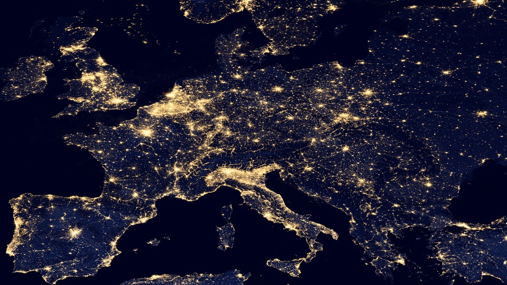
The project employs geospatial data analysis to systematically explore megaregion sustainability. Important insights will be drawn from the NASA Nighttime Lights dataset, which enables quantitative distinguishing of light intensity, allowing for accurate understanding of light emission from geographic areas, including temporal changes. This data can be used to map the changing boundaries of megaregions over time, filling a gap in the literature, as the precise boundaries of megaregions are unknown and constantly shifting. Once the boundaries are determined, it is possible to overlay other types of geospatial data to generate comparative data on a range of sustainability-related issues. The geospatial analysis made possible by this DILAC grant will bring an important new dimension to megaregion research.